Managing stormwater
is a physics problem, and not a very glamorous one. In decades past, the main
objective of managing stormwater was figuring out how fast it could be
directed through the Bay Area’s built landscape via storm drains, culverts,
and channels, and into the Bay. In decades future, however, the object will be
to slow down the runoff, and sink it into greener, spongier surfaces sprinkled
throughout our cities and counties, or to run it through more meandering, more
natural channels and drainages. Such measures fall under the classification of green stormwater
infrastructure. And building more green infrastructure isn’t just some kind of
concept or vision. Instead, the region’s water quality regulators want to see
more of it from local municipalities – enough to make it a requirement of another five-year federally-mandated permit to
discharge stormwater.
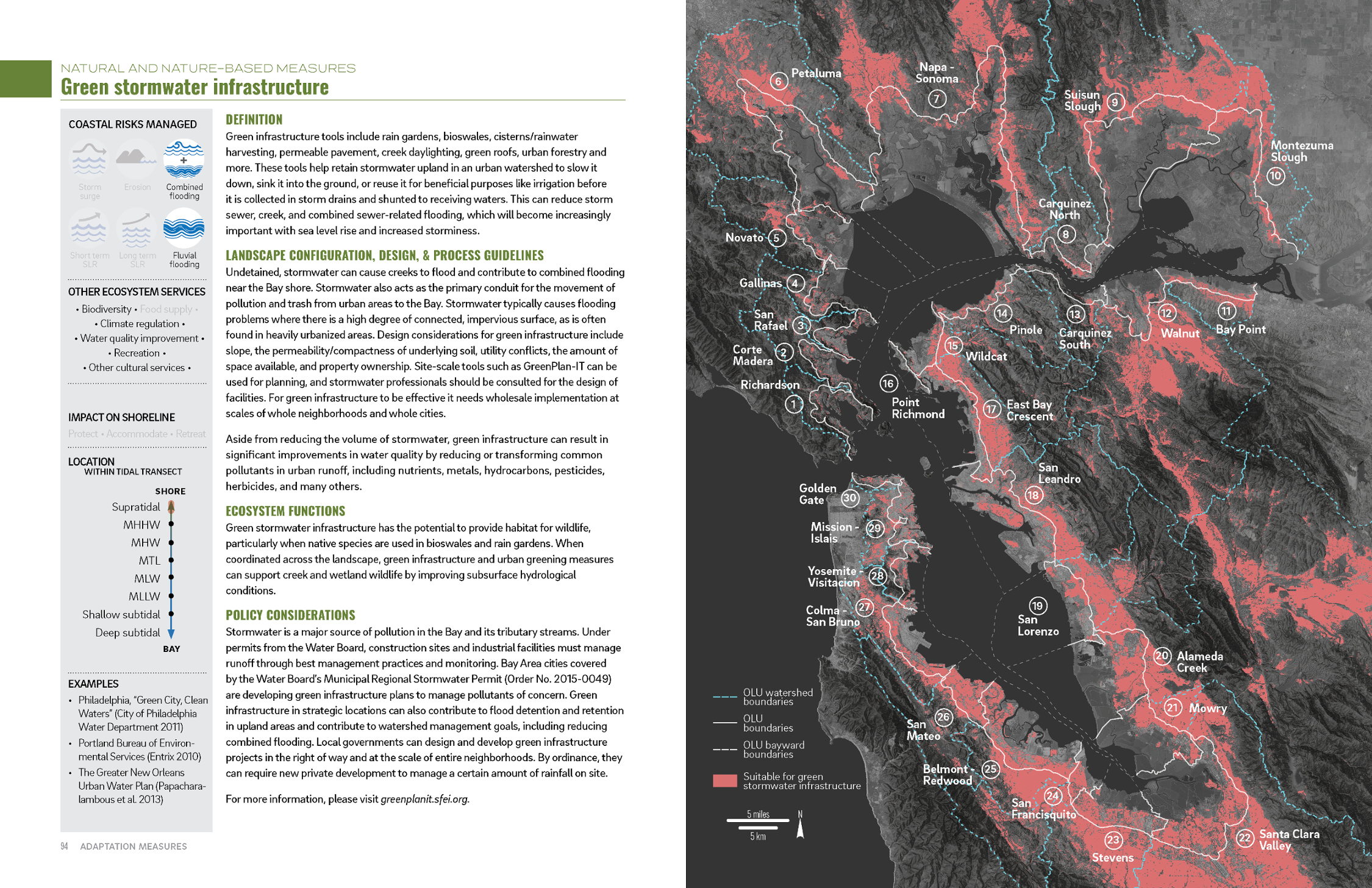
Green infrastructure can be linked to other nature-based infrastructure linking the watershed to the Bay. Image: SFEI Adaptation Atlas.
“The goal is to figure out how we can interrupt the conveyor belt of pollution caused by the grey- infrastructure storm drain system, in which pollutants in urban runoff are discharged to creeks and the Bay without treatment,” says Keith Lichten, Watershed Management Division chief of the San Francisco Bay Regional Water Quality Control Board. This September starts a new planning cycle for the board’s municipal regional permit (see sidebar). During the upcoming cycle, local municipalities will have to show they are compliant with the stormwater permit by incorporating green infrastructure into their future plans.
Of course green
infrastructure has been around for eons, it just hasn’t been on the front
burner for many urban planners. “This is an opportunity for cities to look at
their new and redevelopment plans for the next 25-plus years and figure out
ways to implement stormwater treatment controls by replacing grey
infrastructure with green infrastructure,” says Lichten.
Scaling Up
Green infrastructure
is a loosey-goosey kind of term. Part of the reason is that green
infrastructure is more like a set of design principles — or design outcomes,
really, than it is a strict discipline. Part of the utility of green
infrastructure, particularly with regards to stormwater management — where the
goal is to slow, spread, and sometimes even store runoff — is that the same
principles are scalable across different size projects.
Matt Fabry manages
the San Mateo County-wide Water
Pollution Prevention Program and he explains the three different scales at
which green infrastructure is being developed in the Bay Area, or what he
calls an “evolving state of practice for
managing stormwater.”
The first is at the
parcel or individual property level, particularly during any redevelopment.
“The Water Board recognized that it
is going to take time to change the urban fabric,” Fabry says. Beginning in
2005, the board required that new development or redevelopment that added or
replaced 10,000 square feet or more of impervious surfaces had to have some
way of locally managing runoff. The requirements started with on-site
mechanical filtration but have since moved to a more landscape-based approach
that includes green infrastructure tactics. While the parcel level is the
smallest scale, the funding is also the simplest because the construction
costs become part of the project budget. “Cities are looking at more ways can
get this done with private dollars,” Fabry says.
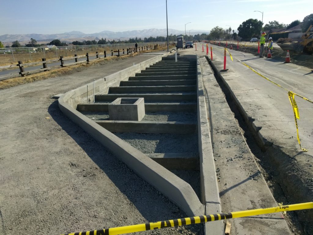
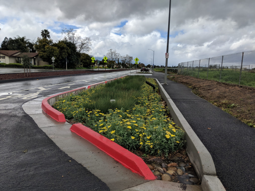
Before and after rain garden’s on San Jose’s Chynoweth Avenue. Photos: City of San Jose
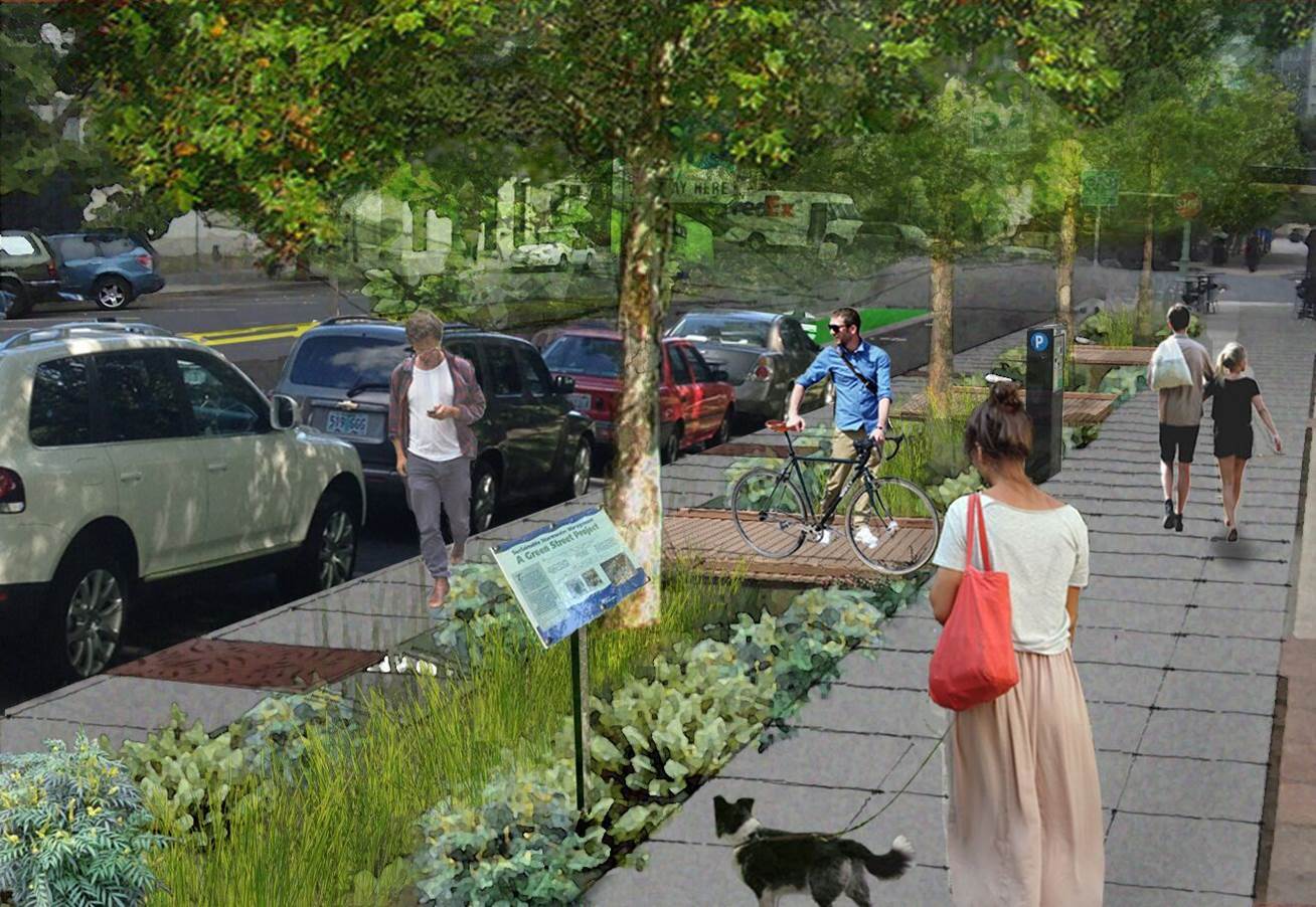
The second scale of
green stormwater infrastructure development is happening at the street or
neighborhood level. The definition of a comprehensive urban street continues
to get more sophisticated. It began with a model called complete streets,
which is more pedestrian and bike friendly. Then came the idea of green
streets, which replaced hard impervious curbs and gutters with pockets of vegetation and deep wells around
street trees that allows water to collect, and cuts in curbs to slow the flow
of water. Those two concepts are now being married together into something
called sustainable streets, which combines the goals of making streets more
pedestrian and bike-friendly while layering the green infrastructure elements
of slowing and spreading stormwater runoff. The sustainable streets model is
currently being implemented in numerous cities around the Bay Area.
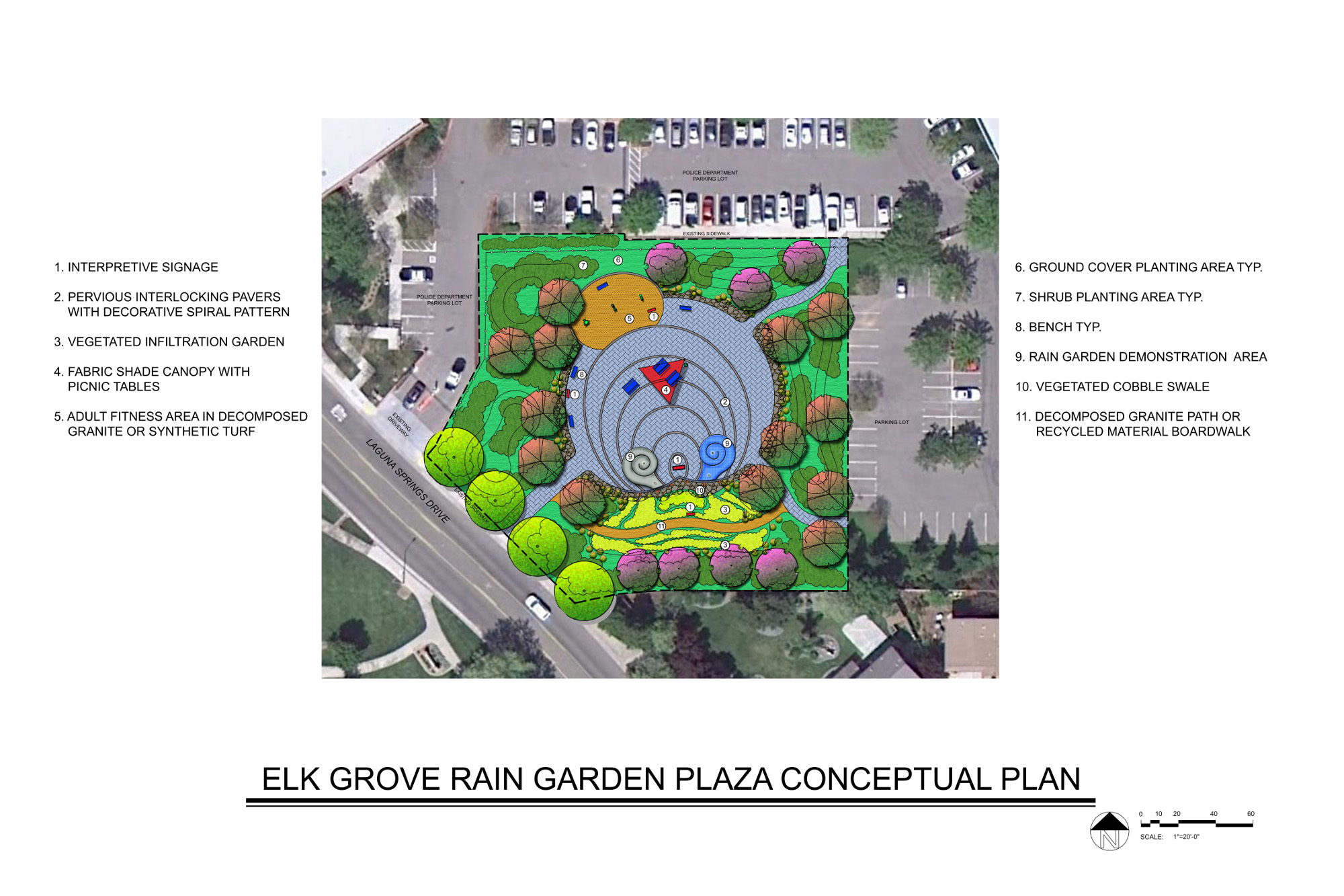
Elk Grove rain garden plaza conceptual plan.
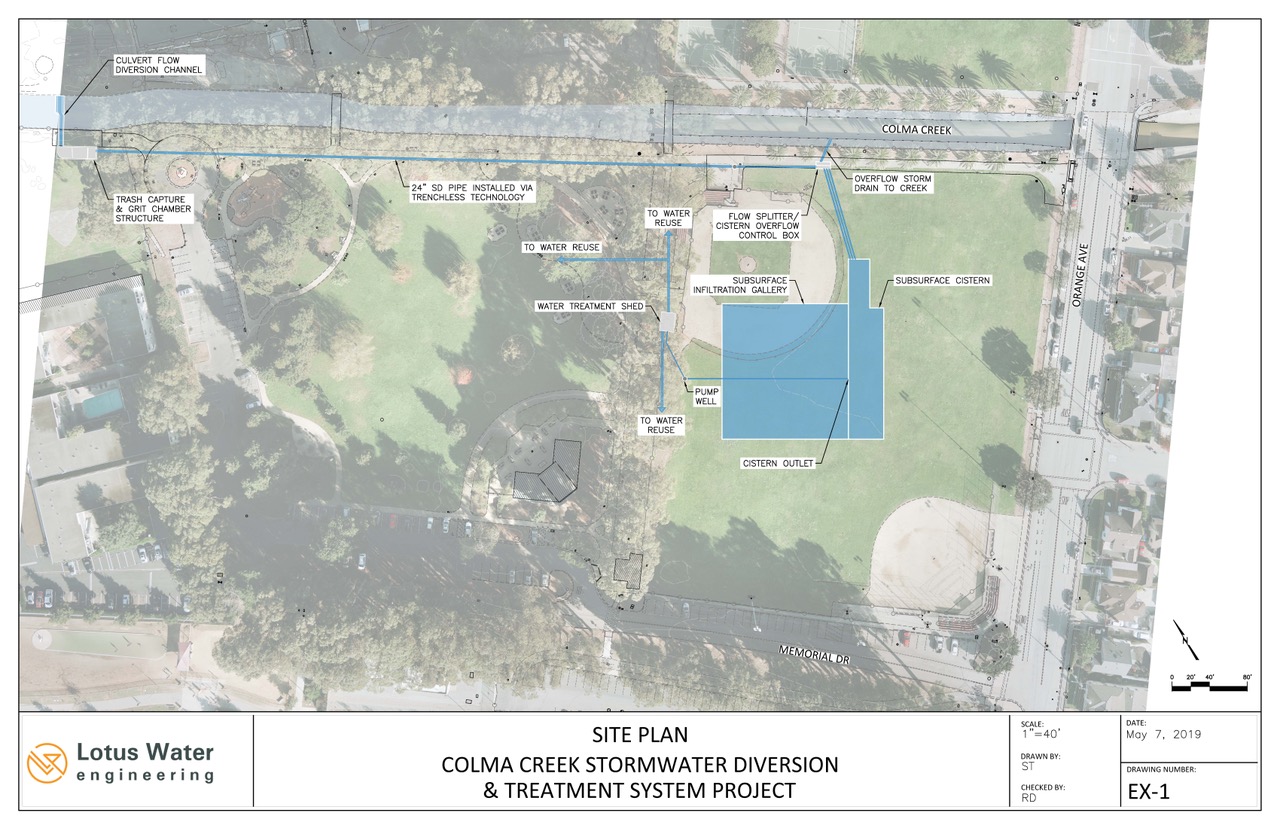
The third level of
scale according to Fabry is happening at the city or watershed level. He
points to a project in the design phase in South San Francisco, where city
officials are working with San Mateo County Flood Control District to re-engineer part of Colma Creek. The
creek, with its headwaters on the flanks of the San Bruno Mountains, currently
drains about 6,500 acres, and while running
through the busy blocks between the 280 and 380 freeways is confined to a
hardened concrete channel. On its way to an outlet in the Bay near the San
Francisco International Airport, the creek passes by the popular Orange
Memorial park. The wide-open baseball and softball fields there provide the
perfect testing ground for a massive green stormwater infrastructure project,
but maybe not in the way you think. After years of planning and public input,
the city and its partners are scheduled to break ground by early next spring
on a project that will put a massive reservoir underneath one of the ball
fields. Before the water hits the subsurface cistern it will be filtered to
remove trash and pollutants, like the heavy metals targeted by the Regional Water
Board. Roughly half of the water will be used to irrigate landscaping around
the park and along the adjacent stretch of Centennial Trail, and the remainder
will be allowed to slowly feed back into the region’s aquifers. Any of the
filtered overflow will be diverted back to the concrete creek where it will
eventually meet the Bay.
Site plan for Colma Creek stormwater diversion and treatment system.
“In addition to the usual challenges
encountered by public infrastructure construction, this particular project has
unique elements requiring several rounds of public outreach and feedback” says
Bianca Liu, Associate Engineer
for the City of South San Francisco and project manager for the Orange
Memorial Park stormwater capture project. “The idea of a
giant underground storage tank in the neighborhood is a new concept, and the
project will require the temporary closure of a portion of a popular park.”
If this mesh of
projects all sounds a little ad-hoc, that’s because so far, green
infrastructure development largely occurs on a case-by-case basis. Until now the
nature of trying to build infrastructure has been inherently opportunistic,
and the new Regional Water Board permitting process aims to change that by
requiring long-term municipal plans. In reality, building any green
infrastructure that crosses the boundaries of a single parcel often requires
the coordination of multiple public agencies and several layers of permitting
requirements.
There’s the additional
wrinkle that green infrastructure can be complicated to fund, although both
project planners and funding agencies are becoming more creative. “It’s amazingly expensive to retrofit the existing
built environment especially when you are doing it as a
standalone project,”
says Josh Bradt, a watershed program manager for the San Francisco Estuary
Partnership. “It only really pencils out when it is part of a bigger project.”
UC Davis Green Instructure Club builds a rain garden. Photo: UC Davis
South San
Francisco’s regional scale green infrastructure project is actually being
funded by $9.5 million from Caltrans. Caltrans has their own water quality
guidelines to meet, and if they can’t do enough on a specific project then
they can find ways to offset impacts by funding a project elsewhere that will reduce
runoff or pollution. “We need to be
talking to the transportation community and natural resources community to see
where these projects can be synced up. Right now, it’s a real jigsaw puzzle to
figure out the funding sources,” Bradt says.
But relying on a connect-the-dots funding
approach is changing. “As far as the funding goes, there are more bonds and
grants out there for green infrastructure projects today than five to ten
years ago, but maybe it’s time green infrastructure becomes a budget line
item,” says Mitch Avalon, who formerly oversaw Contra Costa County’s clean
water program. Avalon has been advocating for new state legislation that would
formally integrate stormwater management into any future regional
transportation projects and funding opportunities, and also working with
regional agencies such as the Bay Area’s Metropolitan Transportation
Commission on other avenues to achieve the same goals. He says the first step
in that process is actually defining what integrating stormwater into
transportation planning actually means on the ground. “If you are familiar
with the Americans with Disabilities Act, you might remember that it was a big
policy decision that required people to change the way things were built. At
first, people thought that was crazy, but eventually compliance just became
another line item in a construction budget,” Avalon says. “As a policy and as
a society, we decided it was important.” The same thing is happening with
green infrastructure funding.
How green infrastructure relates to living, nature based infrastructure opportunities as presented in the new Adaptation Atlas published By SFEI and SPUR in 2019.
Aiming for Multiple Benefits
Realistically,
however, municipalities won’t suddenly be rolling out green infrastructure
projects on every street corner or along every urban creek come September,
when the Regional Water Board’s new planning requirements solidify.
Progress over the last decade has been much slower than some would have
hoped. “It is frustrating to see conventional right of way projects continue
to be undertaken without GI elements when the impacts of landscape hardening
to watershed health are well known,” says the San Francisco Estuary
Partnership’s Josh Bradt. “I am hopeful that the Water Board’s requirement for
watershed-based GI master plans will be a game-changer. At the very least it
should encourage much better coordination.”
Right now, cities fall along a spectrum
of readiness, some report still being in the planning phase, while others are
much farther along. “Oakland is prepared to meet the current regulations, says
Kirstin Hathaway, acting Watershed and Stormwater Division Program manager for
the City of Oakland. “We see green infrastructure as important for the city
beyond the regulatory requirements.”
One factor that helps build enthusiasm
among planners is that while the board’s permit requirements are focused on
reducing urban runoff pollutants including PCBs, mercury, and trash from
entering the Bay, there are many other compelling reasons for increasing the
acreage of green infrastructure around the region.
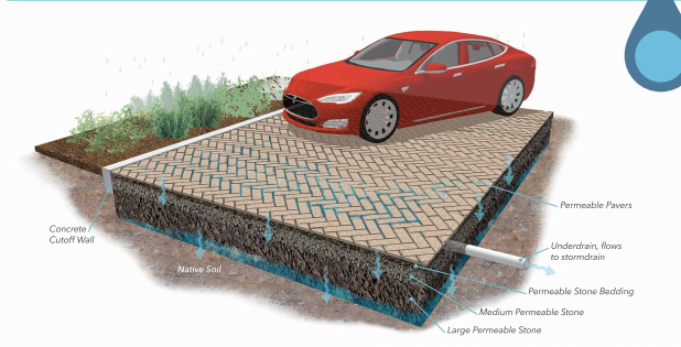
Caption: Permeable pavers from Turner Court demonstration parking lot project and Alameda County Public Works green infrastructure program. Photo: ACPWA
As described earlier, sustainable streets could not only reduce pollution but
also add buffers that might be useful in a changing climate, such as more
vegetation to help with heat island effects or a place to capture surge events
that will likely happen secondary to sea level rise. And the larger, regional
projects like the one underway at Orange Memorial Park can be used to capture and store stormwater that today
might be used to irrigate a ball field, but in the future could be used for
other purposes. Not to mention that green infrastructure just generally makes
the built environment more comfortable and livable — a factor not always
accounted for or built into project cost analysis.
“It takes a little bit of time to get these things baked
together,” says Michael Germeraad, a resilience planner with the Metropolitan
Transportation Commission and Association of Bay Area Governments, referring
to how people are starting to talk about the advantages of green
infrastructure as a means to accomplish multiple objectives. “As municipalities
adopt plans in the next two years, I think we will see increased pressure to
start including green infrastructure and planning so that one plus one equals
three.”
And for some
communities thinking about how to insulate against the impacts of climate
change and sea level rise isn’t really about planning for the future — because
the forecasted scenario of increased flooding has already arrived.
“We’ve actually had
people kayaking in our streets,” says Elizabeth Patterson, the Mayor of
Benicia where a citizen group called Sustainable Solano is leading the charge
and training residents about resilience. “This is not just a reaction to
regulations, not just because the state was saying you have to do this, a lot
of municipalities are asking for help for this.”
Oakland green infrastructure vision. Photo: Kevin Robert Perry
Ruling Over Runoff
During wet weather events, stormwater comes pouring down from Bay Area hillsides and collects in the lowlands. This makes sense because historically the fringes of the Bay were perfect catch basins for heavy flows. But starting more than a century ago those low-lying basin-like areas have been filled in with homes and buildings and with roads and parking lots. As the Bay Area became built and developed hard surfaces, greater quantities of runoff raced over the landscape.
Then, following the passage of the Clean Water Act of 1972, came the awakening that stormwater was more than just a flooding issue. The flows, it was acknowledged, could be laced with concentrations of toxins rivaling that of the end-of-pipe sources that the Clean Water Act was written to control. By the late 1980s, and after the passage of more federal water quality legislation, states were put in charge of making sure that municipalities were meeting stormwater requirements outlined by the National Pollutant Discharge Elimination System (NPDES), the regulatory teeth of the Clean Water Act.
In California, the State Water Resources Control Board and Regional Water Quality Control Boards are tasked with making sure that local agencies are operating in compliance with NPDES. Beginning in the 1990s, the San Francisco Bay board began issuing NPDES permits for municipal stormwater discharges, which eventually grew into the Municipal Regional Permit, also known as the MRP, as of 2009. The MRP requires Bay Area municipalities to clean up urban runoff pollution and, over time, to improve the way the urban environment is built to reduce the amounts of pollutants it discharges. And because the Bay Area has legacy contaminants from previous industrial and urban activities — particularly mercury and PCBs (both of which accumulate in food chains, especially fish, and pose health risk to the people that eat eventually eat the fish) — that get stirred up and carried to the Bay during storm events, the MRP targets those pollutants specifically, along with reducing the amount of trash that enters creeks and the Bay during storms.
Daniel McGlynn worked as an itinerant naturalist, trip leader, and wilderness guide before serving as an environmental educator with the Peace Corps in rural Nicaragua. Realizing that storytelling is a great educational tool, and productive way to inspire understanding and change, he then turned his attention to science and environmental writing. He is an alum of UC Berkeley’s Graduate School of Journalism and his work has appeared in a handful of national publications. He frequently writes about infrastructure projects and restoration work for Estuary News. Connect with him at danielmcglynn.com.
Our magazine’s media motto for many years has been “Where there’s an estuary, there’s a crowd.” The San Francisco Estuary is a place where people, wildlife, and commerce congregate, and where watersheds, rivers and the ocean meet and mix, creating a place of unusual diversity. In choosing to tell the...
Ever since the state and federal water projects were built in the 1930s and 1940s, California has captured snowmelt in foothill reservoirs, and moved the fresh water from dam releases and river outflows to parched parts of the state via aqueducts hundreds of miles long. A convoluted system of ancient...
Though the Clean Water Act did an amazing job of reducing wastewater and stormwater pollution of the San Francisco Estuary, some contaminants remain thorny problems. Legacy pollutants like mercury washed into the watershed from upstream gold mining, PCBs from old industrial sites, and selenium from agricultural drainage in the San...
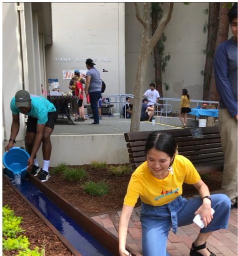
Hothouse Earth
By Ariel Rubissow Okamoto
Photo by Megan Nguyen
Nothing could be stranger than sitting in the dark with thousands of suits and heels, watching a parade of promises to decarbonize from companies and countries large and small, reeling from the beauties of big screen rainforests and indigenous necklaces, and getting all choked up.
It was day two of the September 2018 Global Climate Action Summit in San Francisco when I felt it.
At first I wondered if I was simply starstruck. Most of us labor away trying to fix one small corner of the planet or another without seeing the likes of Harrison Ford, Al Gore, Michael Bloomberg, Van Jones, Jerry Brown – or the ministers or mayors of dozens of cities and countries – in person, on stage and at times angry enough to spit. And between these luminaries a steady stream of CEOs, corporate sustainability officers, and pension fund managers promising percentages of renewables and profits in their portfolios dedicated to the climate cause by 2020-2050.
I tried to give every speaker my full attention: the young man of Vuntut Gwichin heritage from the edge of the Yukon’s Arctic National Wildlife Refuge who pleaded with us not to enter his sacred lands with our drills and dependencies; all the women – swathed in bright patterns and head-scarfs – who kept punching their hearts. “My uncle in Uganda would take 129 years to emit the same amount of carbon as an American would in one year,” said Oxfam’s Winnie Byanyima.
“Our janitors are shutting off the lights you leave on,” said Aida Cardenas, speaking about the frontline workers she trains, mostly immigrants, who are excited to be part of climate change solutions in their new country.
The men on the stage, strutting about in feathers and pinstripes, spoke of hopes and dreams, money and power. “The notion that you can either do good or do well is a myth we have to collectively bust,” said New Jersey Governor Phil Murphy whose state is investing heavily in offshore wind farms.
“Climate change isn’t just about risks, it’s about opportunities,” said Blackrock sustainable investment manager Brian Deese.
But it wasn’t all these fine speeches that started the butterflies. Halfway through the second day of testimonials, it was a slight white-haired woman wrapped in an azure pashmina that pricked my tears. One minute she was on the silver screen with Alec Baldwin and the next she taking a seat on stage. She talked about trees. How trees can solve 30% of our carbon reduction problem. How we have to stop whacking them back in the Amazon and start planting them everywhere else. I couldn’t help thinking of Dr. Seuss and his truffala trees. Jane Goodall, over 80, is as fierce as my Lorax. Or my daughter’s Avatar.
Analyzing my take home feeling from the event I realized it wasn’t the usual fear – killer storms, tidal waves, no food for my kids to eat on a half-baked planet – nor a newfound sense of hope – I’ve always thought nature will get along just fine without us. What I felt was relief. People were actually doing something. Doing a lot. And there was so much more we could do.
As we all pumped fists in the dark, as the presentations went on and on and on because so many people and businesses and countries wanted to STEP UP, I realized how swayed I had let myself be by the doomsday news mill.
“We must be like the river, “ said a boy from Bangladesh named Risalat Khan, who had noticed our Sierra watersheds from the plane. “We must cut through the mountain of obstacles. Let’s be the river!”
Or as Harrison Ford less poetically put it: “Let’s turn off our phones and roll up our sleeves and kick this monster’s ass.”
4th California Climate Change Assessment Blues
by Isaac Pearlman
Since California’s last state-led climate change assessment in 2012, the Golden State has experienced a litany of natural disasters. This includes four years of severe drought from 2012 to 2016, an almost non-existent Sierra Nevada snowpack in 2014-2015 costing $2.1 billion in economic losses, widespread Bay Area flooding from winter 2017 storms, and extremely large and damaging wildfires culminating with this year’s Mendocino Complex fire achieving the dubious distinction of the largest in state history. California’s most recent climate assessment, released August 27th, predicts that for the state and the Bay Area, we can expect even more in the future.
The California state government first began assessing climate impacts formally in 2006, due to an executive order by Governor Schwarzenegger. California’s latest iteration and its fourth overall, includes a dizzying array of 44 technical reports; three topical studies on climate justice, tribal and indigenous communities, and the coast and ocean; as well as nine region-specific analyses.
The results are alarming for our state’s future: an estimated four to five feet of sea level rise and loss of one to two-thirds of Southern California beaches by 2100, a 50 percent increase in wildfires over 25,000 acres, stronger and longer heat waves, and infrastructure like airports, wastewater treatment plants, rail and roadways increasingly likely to suffer flooding.
For the first time, California’s latest assessment dives into climate consequences on a regional level. Academics representing nine California regions spearheaded research and summarized the best available science on the variable heat, rain, flooding and extreme event consequences for their areas. For example, the highest local rate of sea level rise in the state is at the rapidly subsiding Humboldt Bay. In San Diego county, the most biodiverse in all of California, preserving its many fragile and endangered species is an urgent priority. Francesca Hopkins from UC Riverside found that the highest rate of childhood asthma in the state isn’t an urban smog-filled city but in the Imperial Valley, where toxic dust from Salton Sea disaster chokes communities – and will only become worse as higher temperatures and less water due to climate change dry and brittle the area.
According to the Bay Area Regional Report, since 1950 the Bay Area has already increased in temperature by 1.7 degrees Fahrenheit and local sea level is eight inches higher than it was one hundred years ago. Future climate will render the Bay Area less suitable for our evergreen redwood and fir forests, and more favorable for tolerant chaparral shrub land. The region’s seven million people and $750 billion economy (almost one-third of California’s total) is predicted to be increasingly beset by more “boom and bust” irregular wet and very dry years, punctuated by increasingly intense and damaging storms.
Unsurprisingly, according to the report the Bay Area’s intensifying housing and equity problems have a multiplier affect with climate change. As Bay Area housing spreads further north, south, and inland the result is higher transportation and energy needs for those with the fewest resources available to afford them; and acute disparity in climate vulnerability across Bay Area communities and populations.
“All Californians will likely endure more illness and be at greater risk of early death because of climate change,” bluntly states the statewide summary brochure for California’s climate assessment. “[However] vulnerable populations that already experience the greatest adverse health impacts will be disproportionately affected.”
“We’re much better at being reactive to a disaster than planning ahead,” said UC Berkeley professor and contributing author David Ackerly at a California Adaptation Forum panel in Sacramento on August 27th. “And it is vulnerable communities that suffer from those disasters. How much human suffering has to happen before it triggers the next round of activity?”
The assessment’s data is publicly available online at “Cal-adapt,” where Californians can explore projected impacts for their neighborhoods, towns, and regions.


 The results are alarming for our state’s future: an estimated four to five feet of sea level rise and loss of one to two-thirds of Southern California beaches by 2100, a 50 percent increase in wildfires over 25,000 acres, stronger and longer heat waves, and infrastructure like airports, wastewater treatment plants, rail and roadways increasingly likely to suffer flooding.